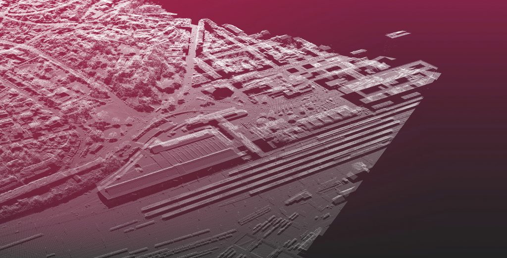
Post City Linz
550 rejected
type: spatial
origin: ValueError
location: AT:\OOE\Linz\4020\Waldeggstraße 41
runtime: 2014-ongoing
references: Allhaming logistics center
Until 1948, Linz's main post office was located on Domgasse. Due to the better location and transport connections, the main post office was moved to Linz main train station and the existing post office there was expanded. In 1994, an extension was built in the form of a three-story postal distribution center. After only 20 years of use, the logistics center at the main train station was closed due to insufficient capacity. The emergence of online trading and the resulting increase in parcel volumes as well as the economic pressure to establish accelerated logistics chains made a new location necessary.
What remains is a large industrial wasteland in a central location. Since the distribution center was shut down, there has been discussion about its subsequent use or conversion. From 2015 to 2019, the Ars Electronica Festival took place in the empty building. In 2015 the main building was used as refugee accommodation. Both can be seen as implementing a temporary urban patch. An urban update in the form of a mixed-use urban development district is in the planning phase. The announced architectural competition was decided in favor of the design by Nussmüller Architects.
In the Post City Linz project, public interests, such as traffic planning or the creation of living space, are mixed with an economic viability calculation - not least through the participation of private shareholders in Post AG.
Allhaming logistics center
type: graphics
origin: ValueError
location: AT:\OOE\Allhaming\4511\Poststraße 2
runtime: 2014-ongoing
references: PostCity
The Allhaming logistics center was built in 2014 on behalf of the Austrian Post AG as a successor to the mail distribution center in Linz. The previous location at Linz main station was optimized for deliveries by train. Due to the shift in freight movement from rail to road (trucks), Allhaming was chosen as the new location. The new logistics center offers a direct connection to the A1 motorway and modern sorting technologies that can handle 1.6 million letters and 104,000 parcels every day.
Just 7 years later, the Allhaming location was again reaching the limits of its capacity. In 2021, an expansion with a floor area of 125,000 m² was announced to meet the increasing parcel load.
As a graphic glitch, the logistics center shows the systemic incompatibility of globally interconnected supply chains, a just-in-time mentality, and the program of climate and environmental protection.
Flowchart – Post City
Flowcharts, also known as flow charts or program flowcharts, are used to graphically represent processes in computer programs. To solve a problem, an algorithm – a clear guideline for action – is needed. A flowchart shows the implementation of the instructions. The use of various subroutines, loops, conditional statements or branches enables complex tasks to be completed. The more extensive a program is, the more complex its processes often become.
Independent of computer programs, flowcharts are also used to represent activities, workflows or processes. When researching urban developments, a flow chart can be used to clearly define an objective and present those involved as influencing factors. It is also possible to depict processes in the past in order to make their history or causes clear.
How should the optimal urban planning program work? It would require many processes, subprograms and loops, but it would still always follow a transparent and well thought-out process. For many topics such as energy supply, traffic reduction, mobility concepts, quality of life, greening or climate friendliness, there would be a module - a separate subprogram - that can be loaded into new planning projects. However, many important modules are often completely missing or cannot be loaded properly. This raises an ImportError.
An example of this is land consumption in Austria. There are no uniform nationwide specifications for development plans and development concepts. How places, markets and cities develop and which areas are sealed is the responsibility of the states and municipalities. They often do not have the necessary skills to provide a compatible and forward-looking module.
The flowchart shown illustrates the lifespan of the mail distribution center at Linz Central Station. Since it is a building with specific uses, many processes are involved that directly and indirectly influence the benefits. The influencing factors shown are depicted as inputs, outputs, subprograms and processes and only represent direct causalities to a limited extent. Rather, it is an illustration of an overall process that is intended to show at which points an error could occur, a module is missing, or a Overarching development has local effects. The research into the development of the 4 hectare area at the main train station shows that new strategies are needed when dealing with the planning and design of new urban districts. Especially when the owners are partially state-owned corporations. Partially state-owned companies, corporations and companies often own large pieces of land and lots of real estate. Their real estate development has a strong influence on neighborhoods, districts or the entire city and should not be viewed under the guise of benevolent public benefit.
Linz would like to present itself as a city of innovation and climate capital. An important step in this direction would be the innovative and climate-friendly planning and implementation of construction projects in the interests of the population. 150,000 m² of gross floor area potential is expected to open up south-west of the main station in the coming years. The responsible use of sustainable building materials, the best possible reduction in private traffic or the proactive handling of emissions that are unavoidable at the location for the benefit of the residents are just some of the modules that urgently need to be imported into the Linz urban development program.